Pinpoint Critical Risks
Harness advanced GeoIntelligence to accurately identify and mitigate risks to your energy infrastructure

Risk Identification
Accurately identify hazards to enhance infrastructure safety

Solution Deployment
Deploy effective solutions to mitigate identified risks
How it works
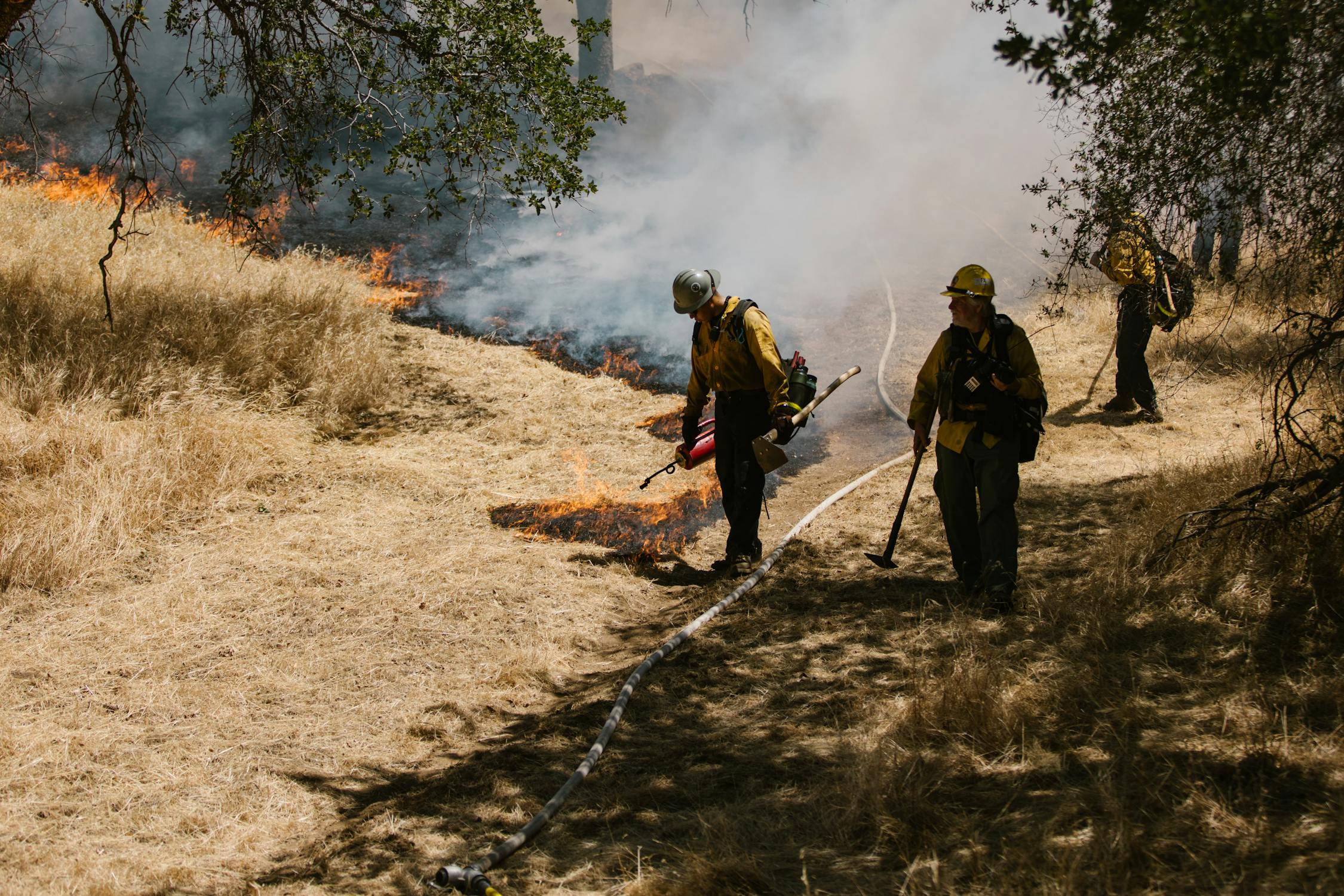
Understanding The Risks
We have fundamental understanding of specific risks associated with energy infrastructure to offer tailored solutions
Mapping
Our GeoIntelligence maps risk areas with precision, highlighting critical zones for intervention
Analysis
Analyze environmental data to assess and predict potential infrastructure threats effectively
Monitoring
Continuously monitor your assets to preemptively tackle risks before they escalate

")
")
How it works
Geospatial AI
Our cutting-edge technology integrates real-time data and predictive analytics for proactive management
- Machine Learning
- Advanced models predict risk scenarios by analyzing large, multimodal, spatiotemporal datasets
- Big Data
- Utilize real-time satellite data for timely and effective risk assessments
- Actionable Intelligence
- Increased insight enables you to make better decisions in less time. Accelerate and strengthen the decision cycle
How it works
Decision Confidence
Experience the relief and security of knowing your infrastructure is monitored and protected
How it works
With Echospectra’s GeoAI, your assets are under vigilant watch, preventing threats from escalating into costly disasters.
- Identify hazards early
- Targeted risk mitigation strategies
- Enhanced operational safety
- Reduced downtime
- Lower insurance premiums
Rest easy as our comprehensive GeoIntelligence services transform risk management into a strategic advantage, securing both your physical and financial infrastructure.

")
Innovation Meets Your Infrastructure Needs With
“Partnering with Echospectra has been a game-changer for our solar power construction projects. They helped us save $12 million on a single project by optimizing our steel orders and reducing earthwork costs. We were able to cut down on material waste, and enhance overall efficiency”

Advanced Mapping
Predictive Analytics
Frequently Asked Questions
How frequently can you monitor corridors from space?
We can monitor corridors on a quarterly, monthly, or weekly basis. High cadence space-based monitoring brings near-realtime information to your team so you can operate with the most up to date information.
What is the smallest change you can detect?
We evaluate change from a few different signals. In the context of satellite imagery, we can reliably detect change on areas measuring about 20 feet per side. This is about the size of a large tree canopy, or a moderate sized shed. We look for changes in tree health and for new structures in and along your right of ways so you can queue the appropriate response. Sometimes this is ground inspection, others it might be aerial patrol.
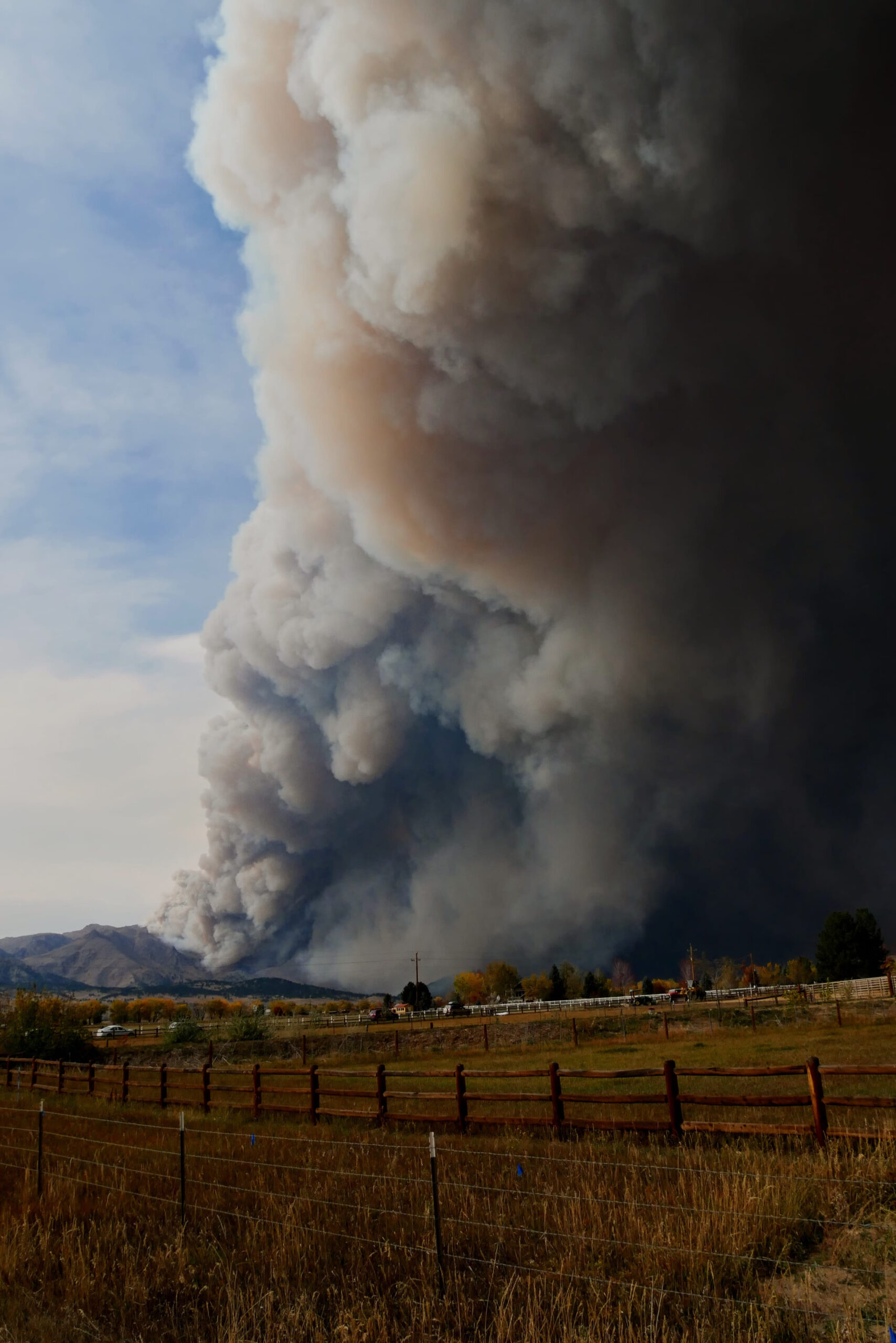
How do you asses fire risk?
Our platform combines multiple data sources to deliver a fire risk assessment that is uniquely accurate and specific to your assets. The base assessment is derived from satellite imagery that delivers key insight to vegetation type, health, dryness, and fuel load. Then, we combine that with local wind and weather data. This allows us to apply a risk index to your assets and alert you to any changes in risk exposure.
Can this help me get fire insurance coverage?
Yes, our product is designed to help you secure and maintain fire insurance coverage. We collaborate with clients to implement proven fire risk management processes. Our system provides clear insights into fire risk areas, allowing your team to execute targeted fire risk abatement plans effectively. By reducing fire risks and maintaining comprehensive documentation, we help you get lower insurance premiums and better coverage terms.
Will this reduce our insurance premiums?
Yes, we have experience working with some of the largest mutual insurance companies providing coverage to the energy industry. We have successfully helped clients keep coverage in the face of uncertain liability exposure, prevented premium increases by demonstrating a best in class asset documentation and audit assurance tool, and reduced premiums by helping our clients exceed insurance providers’ KPI targets.
Does this require IT infrastructure and management?
No, our platform is fully cloud-based and adheres to strict data security standards set by AICPA, Cloud Security Alliance, ISO 27001, NERC, and CISA. However, if you prefer to deploy any part of the service on your local infrastructure, we can accommodate that and work with your team to ensure a smooth setup.
Do I need a data science team to use this product?
No, a data science team is not required, but if you have one, they will love it. Our product is designed to help your organization focus on its core functions, i.e., keeping the lights on, while we provide data-driven intelligence for quicker, more informed decisions. Additionally, we offer a RESTful API, allowing your data science team to interact with the data programmatically as well.
What does Echospectra mean!?
Echospectra is a portmanteau reflecting key aspects of our service. “Echo” represents both digital twins, and active sensing methods to model the world around us. “Spectra” refers to the radiance, frequency, and energy data we specialize in. Together, Echospectra embodies our mission to provide next-generation geospatial intelligence for protecting critical infrastructure.
Get In Touch With Us
Have more questions or need specific details about how Echospectra can address your unique challenges? Fill out our contact form to get personalized assistance. Let’s start a conversation on how we can help you enhance your infrastructure safety and efficiency with our innovative solutions.

More Services
Additional services to enhance your infrastructure’s safety and efficiency